Residential Searches
Groundsure Enviro All-in-OneEnviro All-in-One is a fully integrated residential environmental risk report, brought to you by Groundsure and the Coal Authority.
It is the only available report to combine the official CON29M coal mining search with flood, contaminated Land, ground stability and radon searches.
It also screens other environmental risks such as energy installations, transportation infrastructure and planning applications.
Improvements include:
- Flood risk assessment now includes new 5m groundwater data, in addition to all other flooding sources.
- Uses Land Registry polygons – providing a higher level of accuracy
- Improved format and workflow
- Fewer pages (up to 70% less), reduced printing and postage costs
- Includes only relevant data - no blank maps or excessive data
- Clear and practical next steps and recommendations in plain English jargon free explanation, 70% fewer pages.
This all means that on average you/your clients will spend on average 10 minutes less on each report, keeping your transactions moving.
Key facts:
- The relaunched Enviro All-in-One environmental search report is the only available report to combine a full CON29M Coal Mining with flood, contaminated land, ground stability, radon and screens other risks such as energy, transportation and planning and screens other risks such as energy, transportation and planning.
- The Coal Authority coal mining element of the report answers all the approved Law Society’s coal mining questions when handing property transactions.
- Included within the report you will find information on past, present and future coal mining, underground and opencast coal mining, coal mining subsidence, mine entries, mine gas , surface hazards, coal mining geology and information from the Cheshire Brine compensation board
- An insurance policy is included in the Residential Enviro All-in-One covering £50,000 diminution in property value if there is a change in information. Insurance is covered by Liberty Legal Indemnities
- A buffer zone of 20m is included within the report for recorded mine entries to satisfy what the Law Society, the Royal Institute of Chartered Surveyors, the Council of Mortgage Lenders and the Association of British Insurers deems an appropriate distance when evaluating risk.
- The report is based on and limited to the records held the Coal Authority and the Cheshire Brine Subsidence Board’s records at the time we answer the search
- The appropriate follow-on reports are recommended, based on the information returned in the initial search allowing you to make an informed decision
- Residential reports are measured 0-15 hectares (on coalfield only)
- Flood risk assessment now includes new 5m groundwater data, in addition to all other flooding sources
- Enhanced transportation summary – provides detail on HS2 (route, safeguarding, stations & depots); Crossrail 1 (route, stations, worksites); Railways (active railways, stations)
- Enhanced screening on planning applications
- Enhanced visual and cultural designations – e.g. building conservation areas, listed buildings
- Fewer pages with clearer information (up to 70% fewer pages when compared to other reports) means:
- Time savings of, on average, 10 minutes per report with our research showing that some customers expect a saving of up to 30 minutes per report
- Reduced printing and postage costs
- Smaller file sizes Enviro All-in-One has a file size that is up to 50% smaller than other reports
- Only the relevant data - no blank maps or pages, less words, more facts.
- Enviro All-in-One has an intuitive layout, and design, clearer navigation, and colour coded risk ratings with a pass/next steps indicator on the first page of the report meaning:
- Quick interpretation, you can get to the information you and your clients need faster
- Risks are identified clearly and easily - enabling faster and smarter decisions
- Land Registry polygons are used - improving the accuracy of site boundary. This boundary is overlaid onto MasterMap on the front page, the most detailed, up-to-date and comprehensive map data available in the UK
- Easy to understand, with all text written in plain English and without jargon. This makes the report easier to read and the homebuyers themselves can understand the report. With clear recommendations and next steps outlined • Enhanced view on potential and planned energy installations and transport infrastructure
- The environmental searches use Groundsure’s Historical Land Use Database – one of the most comprehensive resources available
- The most accurate database for storage tanks, energy features and military installations
- Groundsure pre & post-sales support from 30+ in-house qualified environmental professionals
GroundSure Enviro All-in-One PDF £111.18
Delivery est. time 24hr
More products
Bath Stone
Identifies any historic underground extraction of Bath Stone or Fullers Earth or any metalliferous mining activity relating to the property.
Coal Authority - Ground Stability
Information on coal mining, brine subsidence claims and natural subsidence hazards
Coal Authority - Mine Entry Interpretive Report
This report provides additional information when mine entries have been revealed in the initial search.
Coal Authority - Mine Gas Emissions Report
Managing coal mine gas liabilities is part of the Coal Authority’s statutory obligations.
Coal Authority - Search Not Required Certificate
Confirmation that an official search is not required.
Coal Authority - Subsidence Claim
Managing coal mining subsidence claims is part of the Coal Authority’s statutory obligations.
Coal Authority - Subsidence Claim 50m buffer Report
Managing coal mining subsidence claims is part of the Coal Authority’s statutory obligations.
Coal Authority - Subsidence Claim History Report
Managing coal mining subsidence claims is part of the Coal Authority’s statutory obligations.
Coal Authority - Surface Hazard incident report
Managing coal mining surface hazards is part of the Coal Authority’s statutory obligations.
Coal Authority CON29M
Information on coal mining and any claims made for the remediation of subsidence.
Coal Authority Consultants Coal Mining Report
Designed by environmental consultants and geotechnical engineers, offers essential data and guidance on historic coal mining activity and the potential issues.
Dye & Durham Enviro Standard
Environmental + Flood + Ground Stability (with a Professional Opinion provided on all data) Contains all of the information from the Dye & Durham Essential report and includes Ground Stability data.
Dye & Durham CON29M Report
The Dye and Durham CON29M report is an official Law Society legal search form used when buying and selling domestic properties within coal mining reporting zones.
Dye & Durham Enviro Essential
Environmental + Flood (with a Professional Opinion provided on all data) Meets the requirements of the Law Society’s guidance on flooding and contaminated land.
Dye & Durham Flood Appraisal
A property specific analysis of flood risk designed to provide additional insight following a Flood ‘Further Action’ result on an initial environmental search.
Dye & Durham Ground Stability Report
The Dye & Durham Ground Report expertly interprets the risk from coal and all other mining, soil-related subsidence and other natural ground hazards, including coastal hazards and recorded ground movement.
Dye & Durham Premium
Environmental + Flood + Ground Stability + Energy & Infrastructure (with a Professional Opinion provided on all data)
Dye & Durham Premium Plus Planning
A discounted combined product of the Dye & Durham Plansearch and Envirosearch reports.

Groundsure Avista
Avista is the most comprehensive environmental search report available with ten key searches.
Groundsure Cheshire Salt Search
Groundsure is the sole provider of the Cheshire Salt Search report in partnership with the Cheshire Brine Subsidence Compensation Board.
Groundsure CON29M
The Groundsure CON29M Official Coal Mining Search is an official CON29M coal mining report for residential or commercial properties, brought to you by Groundsure and Mining Searches UK licensed by the Law Society using official Coal Authority Data.
Groundsure Energy & Transportation
Groundsure’s Energy and Transportation is a new report providing a comprehensive search of existing and planned energy and transport infrastructure.
Groundsure Flood
Groundsure Flood has been redesigned with new features, improved layout and design for clearer navigation improving workflow for conveyancers. This comprehensive report provides a professional assessment of all flood risks.
Groundsure GeoRisk
Historic mining and ground stability affects properties across the country - your clients’ transactions need protecting. GeoRisk is now the standard to provide that protection and assurance.
Groundsure GeoRisk+
Historic mining and ground stability affects properties across the country - your clients’ transactions need protecting. GeoRisk is now the standard to provide that protection and assurance.
Groundsure Homebuyers
Groundsure’s Homebuyers report has now been enhanced and improved. Based on Land Registry polygons, with new features, improved layout and design and clearer navigation improving workflow for solicitors the report now includes full planning, energy and transportation searches.
Groundsure Homescreen
Groundsure Homescreen has been redesigned with new features, improved layout and design for clearer navigation improving workflow for conveyancers. This fully interpreted, risk-rated screening report now uses Land Registry polygons, with enhanced energy, transportation and planning application & restrictions screenings and now now includes a full flood search and complies with Law Society guidance on flood.
Groundsure Planning
Groundsure Planning has been redesigned with new features, improved layout and design for clearer navigation improving workflow for conveyancers. Its complete planning info enables informed property decisions.

Landmark Climate Change Report
The Landmark Climate Change Residential Report is a desktop report, designed to enable property professionals to understand how climate change could impact a given property.
Landmark Coal
The Landmark Coal report in collaboration with mining experts Pinpoint is a Regulated, CON29M compliant Coal Report.
Landmark Coal CON29M
Landmark's Official CON29M Law Society-accredited coal report in collaboration with mining experts PinPoint.
Landmark Energy & Infrastructure
The Energy & Infrastructure report provides accurate and reliable information on a variety of infrastructure and transport projects that could have an impact upon a purchaser’s enjoyment of a property.
Landmark Envirosearch
Envirosearch is Landmark’s core environmental risk screen. The report provides a contaminated land liability risk assessment under Part 2A of the EPA. Alongside this the report provides detailed risk screens of data to confirm whether flood risk, energy & infrastructure projects, ground stability or radon could also be an issue at the property. If identified, a report providing a risk assessment is recommended.
Landmark Flood
Landmark Flood (Previously HCPF) is a detailed flood risk assessment. The assessment is derived following a review of a comprehensive suite of flood data extending beyond the four main sources of flooding including historic flood events, the river network and the elevation of the Site in relation to these features. If a High risk is indicated by flood data, an environmental consultant at Argyll will review the risk to ensure the overall assessment is accurate.
Landmark Homecheck Environmental
Homecheck Professional provides a contaminated land liability risk assessment under Part 2A of the EPA. Alongside this, the report screens data to provide a basic understanding of whether flood risk, ground stability or radon could also be an issue. If identified, a report providing a risk assessment is recommended.
Landmark Mining & Subsidence
The Landmark Mining and Subsidence report provides detailed data and mapping of potential mining and subsidence hazards at the property. Including a comprehensive suite of data, the report includes a clear front-page summary as well as a detailed professional opinion and next steps that can be copied into you client documentation when necessary.
Landmark Riskview
Riskview Residential is an All-In-One report that provides its users with comprehensive environmental due diligence. It provides both a contaminated land liability risk assessment under Part 2A of the EPA as well as a flood risk assessment, which will be reviewed by an Argyll Consultant if a high risk is identified. As it is all encompassing, it also provides a full review of ground stability and radon, energy and infrastructure projects and planning information.
Landmark Riskview Residential + Landmark Coal
The Landmark Riskview Residential and Landmark Coal report search bundle provides a complete two report solution to environmental due diligence.
Landmark Riskview Residential + Landmark Planning
The Riskview Residential and Landmark Planning report search bundle provides a comprehensive and detailed environmental due diligence. Riskview Residential is an All-In-One report that provides its users with comprehensive and compliant environmental due diligence. Both the contaminated and flood assessments are provided by consultants where a high risk could exist for market leading accuracy and advice.
Landmark Site Solutions
The Landmark Site Solutions Residence report is a fully consultant led contaminated land and flood risk assessment.
Radon Advisory
A full report on the requirement for radon protective measures in new buildings and extensions.
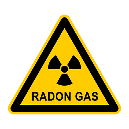
Radon Risk
A report to confirm whether or not the property is in a radon affected area.

Tin - Cornwall Consultants
This is search is submitted to Cornwall Consultants and the result includes information on the presence of disused underground metal mining workings that could cause subsidence, etc.

