Sewer and Water Plans
DXF Sewer and Water Plans with depths (via email)DXF AutoCAD data file format of water mains and sewer plans that Yorkshire Water are responsible for. Includes where available, sewer invert depths.
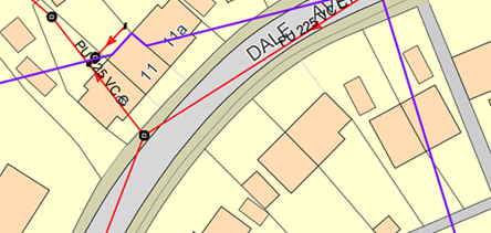
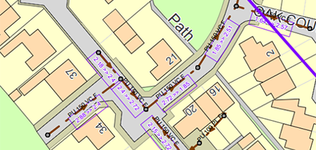
The DXF format contains one "document" which show the sewers, water mains and other assets as layers which can be switched on and off as required.
Please note that not all sewer invert depths are recorded in all areas and be aware that Yorkshire Water's plans only display the public water and sewer pipe assets that it owns and has plotted.
Private water and drainage pipe plans around a property are not kept or shown.
Get Confirmation
If you'd like confirmation that your DXF file will display the data you need before you purchase it, please give our friendly search advisors a call first on 0333 220 6664 (9am-4pm, Mon-Fri).
Some areas of Yorkshire border with neighbouring water companies, e.g Severn Trent to the south, United Utilities to the west and Northumbrian Water to the north where either the water or sewerage catchment area is outside of Yorkshire, the same charge for our plans will still apply.
In these instances we will provide details of the water company you need to contact for them to provide the additional asset plan.
DXF Sewer and Water Plans with depths (via email) £69.67
Delivery est. time 24hr
More products
DXF Sewer and Water Plans (via email)
DXF AutoCAD data file format sewer and water plans showing plotted public assets owned by Yorkshire Water. Delivered as a DXF file attachment by email. Please contact our advisors on 0333 220 6664 if you wish to check that the information you need in the plans is available before ordering.
Sewer and Water Plans (via email)
Sewer and water plans showing plotted public assets owned by Yorkshire Water. Delivered as a PDF by email. Please contact our advisors on 0333 220 6664 if you wish to check that the information you need in the plans is available before ordering.
Sewer and Water Plans with depths (via email)
Sewer and water plans showing plotted public assets owned by Yorkshire Water and displaying where available, sewer invert depths. Delivered as a PDF by email. Please contact our advisors on 0333 220 6664 if you wish to check that the information you need in the plans is available before ordering.
Sewer and Water Plans (paper copies)
Sewer and water plans showing plotted public assets owned by Yorkshire Water. Delivered as a printed copy through the post. Please contact our advisors on 0333 220 6664 if you wish to check that the information you need in the plans is available before ordering.
Sewer and Water Plans with depths (paper copies)
Sewer and water plans showing plotted public assets owned by Yorkshire Water and displaying where available, sewer invert depths. Delivered as a printed copy through the post. Please contact our advisors on 0333 220 6664 if you wish to check that the information you need in the plans is available before ordering.