Residential Searches
Groundsure Cheshire Salt SearchThe Cheshire Salt Search meets the requirements of professionals involved in property transactions and development within the Cheshire Brine Compensation District. Much of Cheshire is at increased risk of subsidence due to the presence of brine and previous mining practices, and the extent of this risk is not always identifiable by proximity to mines. In addition, previous compensation payouts mean that some properties are not eligible for compensation in the event of damage caused.
The report provides information on how these matters affect a given property in Cheshire. It is necessary to obtain it before purchasing a property or conducting development work in the county.
Individual CON29M and Cheshire Salt Search reports are rarely required for the same property. The Cheshire Brine Compensation District and coalfield areas are distinctly separate, apart from a very small overlap area.
Customers purchasing a Cheshire Salt Search report in the Cheshire Brine Compensation District will not need to purchase a CON29M report unless they are located in this salt/coal overlap area. The overlap area is approximately 18.2km² and only holds approximately 259 postcodes, meaning that the number of potential transactions in this region is extremely small.
Key Features:
- Identifies if the property falls within the Compensation District, and hence in an area considered at increased risk of subsidence but potentially eligible for compensation
- Considers if the property would be eligible for compensation under the 1952 and 1964 Acts if it is affected by brine pumping related subsidence in the future
- Explains whether a property is situated in a Consultation Area, meaning it could be difficult to gain planning permission for development, or structural precautions may need to be taken
- Informs whether a Notice of Damage has been filed and accepted for the property, meaning it is already deemed to have been damaged by ground instability caused by brine pumping
- Checks if the property has been subject at any time to a “commutation payment”, meaning it would be eligible for no further compensation in the event of damage. However, if the commuted building has since been demolished and replaced with further building, that building may be potentially eligible for compensation.
- Clarifies whether a property is in an area underlain by a historical salt mine, meaning it is in an area susceptible to subsidence.
- Informs whether the property is within an area designated to be within the GS7 Planning Policy Boundary. The GS7 planning policy ensures that no development takes place within the area covered by the policy until such time that the site is rendered fit for development and mitigated against the serious subsidence risk potentially associated with abandoned rock salt mines in Northwich.
- Checks whether the property is within 20m of a known historical well or shaft.
- Informs whether the property is within 200m of a planning consent of a brine extraction by controlled pumping. Subsidence from controlled pumping is of very low magnitudes.
- Clarifies whether a property is in an area underlain by an active salt mine. The active mine workings are indicated to be stable following a large amount of research, testing and monitoring being carried out at the mine
- Informs whether recorded subsidence features are within 50m of the property, meaning it is in an area susceptible to subsidence.
Groundsure Avista PDF £151.20
Delivery est. time 24hr
More products
Bath Stone
Identifies any historic underground extraction of Bath Stone or Fullers Earth or any metalliferous mining activity relating to the property.
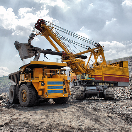
Coal Authority - Ground Stability
Information on coal mining, brine subsidence claims and natural subsidence hazards
Coal Authority - Mine Entry Interpretive Report
This report provides additional information when mine entries have been revealed in the initial search.
Coal Authority - Mine Gas Emissions Report
Managing coal mine gas liabilities is part of the Coal Authority’s statutory obligations.
Coal Authority - Search Not Required Certificate
Confirmation that an official search is not required.
Coal Authority - Subsidence Claim
Managing coal mining subsidence claims is part of the Coal Authority’s statutory obligations.
Coal Authority - Subsidence Claim 50m buffer Report
Managing coal mining subsidence claims is part of the Coal Authority’s statutory obligations.
Coal Authority - Subsidence Claim History Report
Managing coal mining subsidence claims is part of the Coal Authority’s statutory obligations.
Coal Authority - Surface Hazard incident report
Managing coal mining surface hazards is part of the Coal Authority’s statutory obligations.
Coal Authority CON29M
Information on coal mining and any claims made for the remediation of subsidence.
Coal Authority Consultants Coal Mining Report
Designed by environmental consultants and geotechnical engineers, offers essential data and guidance on historic coal mining activity and the potential issues.
Dye & Durham Enviro Standard
Environmental + Flood + Ground Stability (with a Professional Opinion provided on all data) Contains all of the information from the Dye & Durham Essential report and includes Ground Stability data.
Dye & Durham CON29M Report
The Dye and Durham CON29M report is an official Law Society legal search form used when buying and selling domestic properties within coal mining reporting zones.
Dye & Durham Ground Stability Report
The Dye & Durham Ground Report expertly interprets the risk from coal and all other mining, soil-related subsidence and other natural ground hazards, including coastal hazards and recorded ground movement.
Groundsure Enviro All-in-One
Enviro All-in-One is a fully integrated residential environmental risk report, brought to you by Groundsure and the Coal Authority.
Groundsure Avista
Avista is the most comprehensive environmental search report available with ten key searches.
Groundsure CON29M
The Groundsure CON29M Official Coal Mining Search is an official CON29M coal mining report for residential or commercial properties, brought to you by Groundsure and Mining Searches UK licensed by the Law Society using official Coal Authority Data.
Groundsure Energy & Transportation
Groundsure’s Energy and Transportation is a new report providing a comprehensive search of existing and planned energy and transport infrastructure.
Groundsure Flood
Groundsure Flood has been redesigned with new features, improved layout and design for clearer navigation improving workflow for conveyancers. This comprehensive report provides a professional assessment of all flood risks.
Groundsure GeoRisk
Historic mining and ground stability affects properties across the country - your clients’ transactions need protecting. GeoRisk is now the standard to provide that protection and assurance.
Groundsure GeoRisk+
Historic mining and ground stability affects properties across the country - your clients’ transactions need protecting. GeoRisk is now the standard to provide that protection and assurance.
Groundsure Homebuyers
Groundsure’s Homebuyers report has now been enhanced and improved. Based on Land Registry polygons, with new features, improved layout and design and clearer navigation improving workflow for solicitors the report now includes full planning, energy and transportation searches.
Groundsure Homescreen
Groundsure Homescreen has been redesigned with new features, improved layout and design for clearer navigation improving workflow for conveyancers. This fully interpreted, risk-rated screening report now uses Land Registry polygons, with enhanced energy, transportation and planning application & restrictions screenings and now now includes a full flood search and complies with Law Society guidance on flood.
Groundsure Planning
Groundsure Planning has been redesigned with new features, improved layout and design for clearer navigation improving workflow for conveyancers. Its complete planning info enables informed property decisions.

Landmark Coal
The Landmark Coal report in collaboration with mining experts Pinpoint is a Regulated, CON29M compliant Coal Report.
Landmark Coal CON29M
Landmark's Official CON29M Law Society-accredited coal report in collaboration with mining experts PinPoint.
Landmark Mining & Subsidence
The Landmark Mining and Subsidence report provides detailed data and mapping of potential mining and subsidence hazards at the property. Including a comprehensive suite of data, the report includes a clear front-page summary as well as a detailed professional opinion and next steps that can be copied into you client documentation when necessary.
Landmark Riskview Residential + Landmark Coal
The Landmark Riskview Residential and Landmark Coal report search bundle provides a complete two report solution to environmental due diligence.
Landmark Site Solutions
The Landmark Site Solutions Residence report is a fully consultant led contaminated land and flood risk assessment.
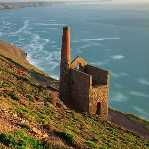
Tin - Cornwall Consultants
This is search is submitted to Cornwall Consultants and the result includes information on the presence of disused underground metal mining workings that could cause subsidence, etc.

